

Recommended


The Tropical Storm Rachel intensified this Wednesday into a Category 1 hurricane and will cause intense and heavy rainfall in several states of the Mexican Pacific, the National Meteorological Service (SMN) reported.
In its most recent report, the agency under the National Water Commission (Conagua) explained that at 6:00 a.m. local time, the center of the storm was located 350 kilometers southwest of Cabo Corrientes, Jalisco, and 570 kilometers west of Lázaro Cárdenas, Michoacán.

Rachel also had maximum sustained winds of 140 kilometers per hour, gusts of 170 kilometers per hour, and was moving northeast at 17 kilometers per hour.
In the coming hours, the phenomenon will cause intense rainfall, between 75 and 150 millimeters, in the west and south of Jalisco, Colima, the coast of Michoacán, and the southwest of Guerrero, as well as very heavy rainfall, from 50 to 75 millimeters, in the south of Nayarit.
It will also cause sustained winds of 50 to 70 kilometers per hour with gusts of 70 to 90 kilometers per hour on the coasts of Jalisco and Colima, and 30 to 40 kilometers per hour with gusts of 50 to 70 kilometers per hour in the west of Michoacán.
Likewise, waves of between four and six meters in height are expected on the coasts of Jalisco, Colima, and Michoacán.
Due to its proximity to the national coast, the SMN, in coordination with the United States National Hurricane Center (NHC), maintains a tropical storm watch zone from Punta San Telmo, Michoacán, to Playa Pérula, Jalisco, and a surveillance zone from Playa Pérula to Cabo Corrientes, Jalisco.
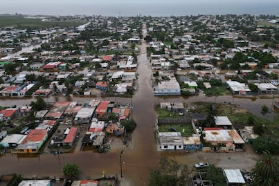
The SMN anticipated that the precipitation generated by Rachel could cause landslides, an increase in river and stream levels, as well as overflows and flooding in low-lying areas of the aforementioned states, for which it urged the population to remain alert to the authorities' warnings.


Rachel became a hurricane just one day after Polo made landfall twice in northwestern Mexico. The cyclone impacted around midnight on Tuesday in the vicinity of Las Barrancas, in the municipality of Comondú, Baja California Sur, as a Category 2 hurricane, with sustained winds of 175 kilometers per hour and gusts of 205.
Hours later, Polo crossed the Gulf of California and made landfall for a second time in the vicinity of Guaymas, Sonora, as a Category 1 hurricane, before weakening.
Polo reached Category 5, the highest on the Saffir-Simpson scale, on September 22, when it recorded maximum sustained winds of 260 kilometers per hour and gusts of 315 kilometers per hour off the coast of the Mexican Pacific.

[Publicidad]