

Recommended

According to the U.S. Weather Prediction Center, a severe winter pattern will keep temperatures extremely low in large areas of the country over the next few days, with heavy snowfall, strong winds, and risks to the population.
Nevadas intensas y lluvias en el noroeste del Pacífico
A frontal system associated with an upper-level trough will enter the Pacific Northwest tonight, causing heavy rain in Washington. While rain will prevail in coastal areas, mountain regions will receive snow, with additional accumulations expected for the rest of the week due to new troughs.
Nieve por efecto lago afectará a los Grandes Lagos y noreste
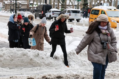
In the Great Lakes, a slow-moving system will intensify lake-effect snow from tonight through Wednesday, also affecting regions of the northeastern United States. After Wednesday, snowfall will continue in a weaker but persistent manner.
Temperaturas bajo cero persistirán en el este de Estados Unidos
The forecast indicates that low temperatures will continue across the eastern two-thirds of the country. During the weekend, a new mass of arctic air will move from the Plains toward the east and southeast, with unusually low readings even in Florida.
Sensación térmica de hasta -20 °C y riesgo mortal
This arctic air will be accompanied by strong winds, creating wind chills of up to -20°C in parts of the Upper Ohio Valley. Authorities warn that extreme cold increases the risk of hypothermia and frostbite, and they recommend the following:
- Abrigarse adecuadamente
- Limitar la exposición al aire libre
- Proteger mascotas y animales
- Prevenir el congelamiento de tuberías

[Publicidad]