

Recommended


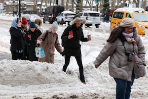
The National Meteorological Service (SMN) of the National Water Commission (Conagua) has issued an alert due to the arrival of an Arctic air mass that will generate freezing to very cold conditions across much of the country. This phenomenon will trigger a very strong 'Norte' event along the coast of the Gulf of Mexico, as well as on the Isthmus and Gulf of Tehuantepec, maintaining dense fog banks in the states of the Northern and Central Mesas.
For Mexico City and the Valley of Mexico, the forecast indicates that cold conditions will persist, with minimum temperatures ranging between 0 and 5 degrees Celsius in the mountainous areas of the capital and the state of Morelos. In the rest of the country, the cold will be even more intense, primarily affecting the mountain regions of the north and center with severe frost.
- TAMBIÉN LEE: Virus Nipah India. Cómo se contagia, ¿de persona a persona? ¿Llegará a México? Síntomas que debes vigilar
Temperaturas mínimas extremas: ¿En qué estados bajará el termómetro a -15 grados?
According to the SMN report, the lowest morning temperatures will be recorded in the mountainous areas of Chihuahua, Durango, and Coahuila, where the thermometer could drop from -15 to -10 degrees Celsius with the presence of frost.

Otros estados que enfrentarán temperaturas críticas son:
• -10 to -5 degrees: High-altitude areas of Baja California, Sonora, Nuevo León, and Tamaulipas.
• -5 to 0 degrees: Mountainous areas of Zacatecas, San Luis Potosí, Aguascalientes, Jalisco, Michoacán, Guanajuato, Querétaro, Hidalgo, State of Mexico, Tlaxcala, Puebla, Veracruz, and Oaxaca.
Evento de Norte muy fuerte y rachas de viento de hasta 110 km/h
The Arctic air mass will drive high-intensity winds. A 'Norte' event is forecast with gusts of 90 to 110 km/h on the Isthmus and Gulf of Tehuantepec (Oaxaca and Chiapas), accompanied by waves 4 to 5 meters high.
In other regions, wind speed and wave height will be distributed as follows:
• Veracruz: Gusts of 60 to 80 km/h and waves of 3 to 4 meters.
• Quintana Roo: Gusts of 50 to 70 km/h.
• Tamaulipas, Tabasco, Campeche, and Yucatán: Gusts of 40 to 60 km/h.
The SMN warns that these strong winds could cause trees and advertising billboards to fall, so the population is urged to follow Civil Protection recommendations.
Pronóstico de lluvias y recomendaciones ante el frío intenso
In addition to the temperature drop, very strong localized rainfall (50 to 75 mm) is expected in Veracruz, Oaxaca, and Chiapas, which could be accompanied by lightning and trigger landslides or flooding in low-lying areas.
Due to these conditions, authorities recommend that citizens dress warmly and stay properly hydrated, avoid sudden temperature changes, and pay special attention to children, the elderly, and people with chronic illnesses.
It is essential to stay informed through official notices from the National Meteorological Service to prevent risks derived from this weather event.

[Publicidad]